Atmospheric precipitation - types, characteristics and symbols. Formation and types of precipitation Type of precipitation
Hello dear friends! In this article I want to tell you about how various sediments are formed, what kind of process it is and where it is formed.
We have all seen various precipitation in our lives, but most likely we have never thought about where it is formed from, what types of precipitation there are, and what processes are involved in all this, how to determine what the weather will be like tomorrow... Let's consider precipitation and its types.
Precipitation - this is the moisture contained in which falls to the Earth in different types: snow, rain, hail, etc. Precipitation is measured by the thickness of the fallen ball of water in millimeters. On average per year globe About 1000 mm of precipitation falls per year, and in high latitudes and deserts - less than 250 mm per year.
Tiny droplets of water vapor in a cloud move up and down rather than hanging. When they fall down, they merge with other droplets of water, but their weight will not allow them to break through the rising air that created them. This process is called “coalescence” (fusion). Let's discuss with you the main types of precipitation.

According to Swedish meteorologist Bergeron's theory, which was put forward in the 1930s, snow and rain are caused by supercooled water droplets that form ice crystals in clouds. Depending on whether these crystals melt during the fall or not, they fall to Earth in the form of rain or snow.
As crystals move up and down in the clouds, new layers grow on them, thus hail forms. This process is called “accretion” (growth).
When water vapor at temperatures from -4°C to -15°C condenses in a cloud, ice crystals stick together and form into snowflakes, thus snow forms.
The shape and size of snowflakes depend on the air temperature and the strength of the winds in which they fall. On the surface, snowflakes form a snow cover that reflects more than half of the sun's ray energy, and the purest and driest snow reflects up to 90% of the sun's rays.
This cools snow-covered areas. Snow cover is capable of emitting thermal energy, and therefore even the slight heat that it has quickly goes into the atmosphere.
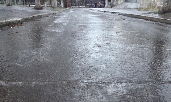
The resulting water when water vapor condenses is rain. It falls from the clouds and reaches the Earth's surface in the form of liquid droplets. Heavy, light and moderate (storm) rains are distinguished depending on the volume of precipitation that fell in a certain period of time.
The intensity of light rain varies from very low to 2.5 mm/h; moderate rain - from 2.8 to 8 mm/h and with heavy rain more than 8 mm/h or more than 0.8 mm in 6 minutes. When there is continuous cloud cover over a large area, there are continuous continuous rains, usually weak and consisting of small droplets.
In smaller areas, rainfall tends to be more intense and consist of larger droplets. Atmospheric precipitation in the form of very small droplets that fall very slowly from fog or clouds is drizzle.
Other precipitations are also distinguished:freezing rain, ice pellets, snow grains, snow pellets, etc. But I will not write about this, because from the example of basic precipitation written above, you can now clearly understand all these meanings yourself. All this precipitation has the following consequences: ice, frozen trees... and they are very similar to each other.
Cloudiness.
Her can be determined by eye. It varies in oktas on an 8-point scale. For example, 0 oktas – cloudless sky, 4 oktas – half the sky is covered with clouds, 8 oktas – completely cloudy. The weather can be determined without weather forecasts.
It has a local character: somewhere it's raining, and a few kilometers away the weather is clear. Sometimes it may not be kilometers, but meters (it’s clear on one side of the street, but it’s raining on the other), I myself have repeatedly witnessed such rain.
Many fishermen and rural residents, as well as elderly people, are able to predict the weather in their area much better by studying clouds.
During sunset, red clouds in the sky often guarantee clear weather the next day. Thunderstorms in summer and hail in winter carry copper-colored clouds with bright silvery edges. The storm is foreshadowed by the dawn sky covered with blood-red spots.
The end of a period of stable weather is often heralded by a sky covered in “lamblets” of cirrocumulus clouds. Changes in weather are often indicated by cirrus clouds ("horses tails") high in the sky. Thunderstorms with rain, snow or hail usually bring cumulonimbus clouds.
You can find out more about all types of clouds
Well, now we have looked at all the precipitation that is important to us, and we know the main signs of the weather 🙂
In the understanding of an ordinary person, precipitation is rain or snow. In fact, there are many more species and all of them, one way or another, are found throughout the year. Among them there are very unusual phenomena, which lead to beautiful effects. What kind of precipitation occurs?
Rain
Rain is the fall of water drops from the sky to the ground as a result of its condensation from the air. During the process of evaporation, water collects into clouds, which later turn into clouds. At a certain moment, the smallest droplets of steam increase, becoming the size of raindrops. Under their own weight, they fall to the surface of the earth.
Rains can be continuous, torrential and drizzle. Covering rain occurs over a long period of time and is characterized by a smooth beginning and end. The intensity of falling drops remains virtually unchanged throughout the rain.
Heavy rains tend to be short-lived and big size drops They can reach five millimeters in diameter. Drizzling rain has droplets less than 1 mm in diameter. It is practically a fog that hangs above the surface of the earth.
Snow
Snow is the precipitation of frozen water, in the form of flakes or frozen crystals. In another way, snow is called dry residues, since snowflakes falling on a cold surface do not leave wet marks.

In most cases, heavy snowfalls develop gradually. They are characterized by smoothness and the absence of a sharp change in the intensity of loss. In severe frost, snow may appear from a seemingly clear sky. In this case, snowflakes are formed in the thinnest cloud layer, which is practically invisible to the eye. Such snowfall is always very light, since a large snow charge requires appropriate clouds.
Rain with snow
This is a classic type of precipitation in autumn and spring time. It is characterized by the simultaneous fall of both raindrops and snowflakes. This happens due to slight fluctuations in air temperature around 0 degrees. Different layers of clouds produce different temperatures, and they also differ on the way to the ground. As a result, some of the drops freeze into snow flakes, and some fly in a liquid state.

hail
Hail is the name given to pieces of ice into which, under certain conditions, water turns before falling to the ground. The size of hailstones ranges from 2 to 50 millimeters. This phenomenon occurs in the summer, when the air temperature is above +10 degrees and is accompanied by heavy rain and thunderstorms. Large hailstones can cause damage to vehicles, vegetation, buildings and people.

Snow pellets
Snow pellets are dry precipitation in the form of dense, frozen snow grains. They differ from ordinary snow in their high density, small size (up to 4 millimeters) and almost round shape. Such grain appears at temperatures around 0 degrees, and may be accompanied by rain or real snow.

Dew
Dew droplets are also considered precipitation, but they do not fall from the sky, but appear on various surfaces as a result of condensation from the air. For dew to appear, a positive temperature, high humidity, and absence of strong wind. Heavy dew can lead to water flowing over the surfaces of buildings, structures, and vehicle bodies.

Frost
This is "winter dew". Frost is water that has condensed from the air but has passed the liquid stage. It looks like a lot of white crystals covering, as a rule, horizontal surfaces.

frost
It is a type of frost, but does not appear on horizontal surfaces, but on thin and long objects. As a rule, umbrella plants, power lines, and tree branches are covered with frost in humid and frosty weather.

Ice
Glaze is a layer of ice on any horizontal surfaces that appears as a result of cooling fog, drizzle, rain or sleet with subsequent temperature drops below 0 degrees. As a result of ice buildup, weak structures can collapse and power line wires can break.
Black ice is a special case of ice that forms only on the surface of the earth. Most often, it forms after a thaw and subsequent drop in temperature.
Ice needles

This is another type of precipitation, which consists of tiny crystals floating in the air. Ice needles are perhaps one of the most beautiful winter atmospheric phenomena, as they often lead to different lighting effects. They are formed at air temperatures below -15 degrees and refract passing light in their structure. The result is halos around the sun, or beautiful "pillars" of light extending from street lamps into clear, frosty skies.
Atmospheric precipitation is moisture that falls to the surface from the atmosphere in the form of rain, drizzle, cereals, snow, and hail. Precipitation comes from clouds, but not every cloud produces precipitation. The formation of precipitation from a cloud occurs due to the enlargement of droplets to a size capable of overcoming rising currents and air resistance. The enlargement of droplets occurs due to the merging of droplets, evaporation of moisture from the surface of droplets (crystals) and condensation of water vapor on others.
Forms of precipitation:
- rain - has drops ranging in size from 0.5 to 7 mm (average 1.5 mm);
- drizzle - consists of small drops up to 0.5 mm in size;
- snow - consists of hexagonal ice crystals formed during the process of sublimation;
- snow pellets - rounded nucleoli with a diameter of 1 mm or more, observed at temperatures close to zero. The grains are easily compressed with your fingers;
- ice pellets - the kernels of the groats have an icy surface, they are difficult to crush with your fingers, and when they fall to the ground they jump;
- hail - large rounded pieces of ice ranging in size from a pea to 5-8 cm in diameter. The weight of hailstones in some cases exceeds 300 g, sometimes reaching several kilograms. Hail falls from cumulonimbus clouds.
Types of precipitation:
- Cover precipitation - uniform, long-lasting, falls from nimbostratus clouds;
- Rainfall – characterized by rapid changes in intensity and short duration. They fall from cumulonimbus clouds as rain, often with hail.
- Drizzle– fall as drizzle from stratus and stratocumulus clouds.
Distribution of annual precipitation (mm) (according to S.G. Lyubushkin and others)
(lines on a map connecting points with the same amount of precipitation over a certain period of time (for example, a year) are called isohyets)
The daily variation of precipitation coincides with the daily variation of cloudiness. There are two types diurnal cycle precipitation – continental and marine (coastal). The continental type has two maximums (in the morning and afternoon) and two minimums (at night and before noon). Marine type– one maximum (at night) and one minimum (daytime).
The annual course of precipitation varies at different latitudes and even within the same zone. It depends on the amount of heat, thermal conditions, air circulation, distance from the coasts, and the nature of the relief.
The most abundant precipitation is in equatorial latitudes, where the annual amount (GKO) exceeds 1000-2000 mm. On the equatorial islands Pacific Ocean 4000-5000 mm falls, and on the leeward slopes of tropical islands up to 10,000 mm. Heavy precipitation is caused by powerful upward currents of very humid air. To the north and south of the equatorial latitudes, the amount of precipitation decreases, reaching a minimum of 25-35º, where the average annual value does not exceed 500 mm and decreases in inland areas to 100 mm or less. In temperate latitudes the amount of precipitation increases slightly (800 mm). At high latitudes the GKO is insignificant.
The maximum annual precipitation was recorded in Cherrapunji (India) - 26461 mm. The minimum recorded annual precipitation is in Aswan (Egypt), Iquique (Chile), where in some years there is no precipitation at all.
Distribution of precipitation across continents as a percentage of the total
|
Australia |
Northern |
|||||
|
Below 500mm |
||||||
|
500 –1000 mm |
||||||
|
Over 1000 mm |
By origin There are convective, frontal and orographic precipitation.
- Convective precipitation are typical for the hot zone, where heating and evaporation are intense, but in summer they often occur in the temperate zone.
- Frontal precipitation are formed when two meet air masses With different temperatures and others physical properties, fall from warmer air that forms cyclonic vortices, typical of temperate and cold zones.
- Orographic precipitation fall on the windward slopes of mountains, especially high ones. They are abundant if the air comes from the side warm sea and has high absolute and relative humidity.

Types of precipitation by origin:
I - convective, II - frontal, III - orographic; TV - warm air, ХВ - cold air.
Annual course of precipitation, i.e. the change in their number by month and in different places on Earth is not the same. Several basic types of annual precipitation patterns can be outlined and expressed as bar graphs.
- Equatorial type – precipitation falls fairly evenly throughout the year, there are no dry months, only after the days of the equinox two small maximums are noted - in April and October - and after the days of the solstice two small minimums are noted - in July and January.
- Monsoon type – maximum precipitation in summer, minimum in winter. Characteristic of subequatorial latitudes, as well as the eastern coasts of continents in subtropical and temperate latitudes. The total amount of precipitation gradually decreases from the subequatorial to the temperate zone.
- Mediterranean type – maximum precipitation in winter, minimum in summer. Observed in subtropical latitudes on western coasts and within continents. Annual precipitation gradually decreases towards the center of the continents.
- Continental type of precipitation of temperate latitudes – in the warm period there is two to three times more precipitation than in the cold period. As the continental climate in the central regions of the continents increases, the total amount of precipitation decreases, and the difference between summer and winter precipitation increases.
- Marine type of temperate latitudes – precipitation is distributed evenly throughout the year with a slight maximum in autumn-winter. Their number is greater than observed for this type.

Types of annual precipitation:
1 - equatorial, 2 - monsoon, 3 - Mediterranean, 4 - continental temperate latitudes, 5 - maritime temperate latitudes.
Literature
- Zubaschenko E.M. Regional Physiography. Earth's climates: teaching aid. Part 1. / E.M. Zubaschenko, V.I. Shmykov, A.Ya. Nemykin, N.V. Polyakova. – Voronezh: VSPU, 2007. – 183 p.
Precipitation
Precipitation
water in a liquid or solid state that falls from clouds or settles from the air onto the earth's surface. Precipitation brings to the land surface all the water involved in water exchange processes (with the exception of certain areas where water comes from underground sources or through watercourses, but it was also previously brought to land by precipitation). The vast majority of precipitation ( rain, drizzle, snow, snowy and icy cereal, hail, freezing rain, etc.) falls from clouds. Released directly from the air dew, frost, hard coating, frost etc. Precipitation is measured in the thickness of the layer of water (usually expressed in millimeters) that falls per unit time. For various purposes, precipitation data for an hour, day, month, year, etc. is used. Usually the amount of precipitation over a short period of time (s, min, h) is also called precipitation intensity. On Wednesday. approx. falls on Earth per year. 1000 mm, minimum in tropical deserts(Atacama in Chile, some regions of the Sahara, etc.) - no more than 10 mm per year (often there is no precipitation at all for several years in a row) and a maximum in the monsoon region in the foothills of the Himalayas (Cherrapunji) - on Wed . OK. 11 thousand mm per year (the maximum precipitation per year that fell there is more than 20 thousand mm). The highest recorded amount of precipitation per day (1870 mm) fell in the form of rain on the island. Reunion in the Indian Ocean in March 1952 during the passage tropical cyclone. Excess rainfall over several hours or days leads to floods, landslides, mudflows and other disasters, and a deficiency within a few weeks or the first months will lead to drought.
Geography. Modern illustrated encyclopedia. - M.: Rosman. Edited by prof. A. P. Gorkina. 2006 .
Synonyms:
See what “precipitation” is in other dictionaries:
PRECIPITATION, in meteorology, all forms of water, liquid or solid, falling from the atmosphere to the ground. Precipitation differs from CLOUDS, FOG, DEW and FROST in that it falls and reaches the ground. Includes rain, drizzle, SNOW and HAIL. Measured by layer thickness... ... Scientific and technical encyclopedic Dictionary
Modern encyclopedia
Atmospheric water in a liquid or solid state (rain, snow, graupel, ground hydrometeors, etc.), falling from clouds or deposited from the air on earth's surface and on objects. Precipitation is measured by the thickness of the layer of fallen water in mm. IN… … Big Encyclopedic Dictionary
Groats, snow, drizzle, hydrometeor, lotions, rain Dictionary of Russian synonyms. precipitation noun, number of synonyms: 8 hydrometeor (6) ... Synonym dictionary
Precipitation- atmospheric, see Hydrometeors. Ecological encyclopedic dictionary. Chisinau: Main editorial office of Moldavian Soviet encyclopedia. I.I. Dedu. 1989. Precipitation, water coming from the atmosphere to the surface of the earth (in liquid or solid... Ecological dictionary
Precipitation- atmospheric, water in a liquid or solid state falling from clouds (rain, snow, pellets, hail) or deposited on the earth's surface and objects (dew, frost, hoarfrost) as a result of condensation of water vapor in the air. Precipitation is measured... ... Illustrated Encyclopedic Dictionary
In geology, loose formations deposited in a suitable environment as a result of physical, chemical and biological processes... Geological terms
PRECIPITATION, ov. Atmospheric moisture falling to the ground in the form of rain or snow. Abundant, weak o. Today there will be no precipitation (no rain, no snow). | adj. sedimentary, oh, oh. Dictionary Ozhegova. S.I. Ozhegov, N.Yu. Shvedova. 1949 1992 … Ozhegov's Explanatory Dictionary
- (meteor.). This name is usually used to denote the moisture that falls on the surface of the earth, being separated from the air or from the soil in dropwise liquid or solid form. This release of moisture occurs every time water vapor constantly... ... Encyclopedia of Brockhaus and Efron
1) atmospheric water in a liquid or solid state, falling from clouds or depositing from the air on the surface of the earth and on objects. O. falls from clouds in the form of rain, drizzle, snow, sleet, snow and ice pellets, snow grains,... ... Dictionary of emergency situations
PRECIPITATION- meteorological, liquid and solid bodies released from the air onto the surface of the soil and solid objects due to the thickening of water vapor contained in the atmosphere. If O. fall from known height, then the rain turns out to be hail and snow; if they… … Great Medical Encyclopedia
Books
- Precipitation and thunderstorms from December 1870 to November 1871, A. Voeikov. Reproduced in the original author's spelling of the 1875 edition (St. Petersburg publishing house). IN…
First of all, let us define the very concept of “atmospheric precipitation”. In the Meteorological Dictionary, this term is interpreted as follows: “Precipitation is water in a liquid or solid state that falls from clouds or settles from the air on the surface of the earth and on objects.”
According to the above definition, precipitation can be divided into two groups: precipitation released directly from the air - dew, frost, frost, ice, and precipitation falling from clouds - rain, drizzle, snow, snow pellets, hail.
Each type of precipitation has its own characteristics.
Dew represents tiny droplets of water deposited on the surface of the earth and on ground objects (grass, tree leaves, roofs, etc.). Dew forms at night or in the evening in clear, calm weather.
Frost appears on surfaces cooled below 0 °C. It is a thin layer of crystalline ice, the particles of which are shaped like snowflakes.
frost- this is the deposition of ice on thin and long objects (tree branches, wires), which forms at any time of the day, usually in cloudy, foggy weather at subzero temperatures (below - 15°C). Frost can be crystalline and granular. On vertical objects, frost is deposited mainly on the windward side.
Among the precipitation deposited on the earth's surface, of particular importance is black ice. It is a layer of dense transparent or muddy ice, growing on any objects (including trunks and branches of trees, bushes) and on the surface of the earth. Formed at air temperatures from 0 to -3°C due to the freezing of drops of supercooled rain, drizzle or fog. A crust of frozen ice can reach a thickness of several centimeters and cause branches to break off.
Precipitation falling from clouds is divided into drizzle, heavy and shower.
Drizzle (drizzle) consist of very small drops of water with a diameter of less than 0.5 mm. They are characterized by low intensity. This precipitation usually falls from stratus and stratocumulus clouds. The speed at which the droplets fall is so slow that they appear to be suspended in the air.
Cover precipitation is rain made up of water droplets small size, or snowfall of snowflakes with a diameter of 1-2 mm. This is long-term precipitation that falls from dense altostratus and nimbostratus clouds. They can continue for several hours and even days, covering vast areas.
Rainfall characterized by high intensity. These are large-droplet and uneven precipitation that falls in both liquid and solid forms (snow, pellets, hail, wet snow). The downpour can last from a few minutes to several hours. The area covered by a rainstorm is usually small.
hail, always observed during a thunderstorm, usually together with heavy rain, is formed in cumulonimbus (thunderstorm) clouds of vertical development. It usually falls in spring and summer in a narrow strip and most often between 12 and 17 hours. The duration of hail is measured in minutes. Within 5-10 minutes, the ground can be covered with a layer of hailstones several centimeters thick. During intense hail, plants can be damaged to varying degrees or even destroyed.
Precipitation is measured by the thickness of the water layer in millimeters. If 10 mm of precipitation fell, this means that the layer of water that fell on the surface of the earth is equal to 10 mm. What does 10 mm of precipitation mean for an area of 600 m2? It's not hard to calculate. Let's start the calculation for an area equal to 1 m2. For her, this amount of precipitation will be 10,000 cm 3, i.e. 10 liters of water. And this is a whole bucket. This means that for an area of 100 m2, the amount of precipitation will already be equal to 100 buckets, but for an area of six acres - 600 buckets, or six tons of water. This is what 10 mm of rainfall is for a typical garden plot.
If you find an error, please highlight a piece of text and click Ctrl+Enter.